GNSS Technology in the World
Its Best Civil Applications
By Max Rogers
 现在是网络时代,我们的生活与网络息息相关。卫星导航定位系统(GNSS)也是我们生活中不可或缺的一样高科技产品。纵观全球,有自己的导航定位系统的国家并不多。世界上有四大卫星导航系统,分别是:中国“北斗”系统、美国GPS卫星导航系统、俄罗斯“格洛纳斯”系统、欧洲“伽利略”系统。
11月5日,我国在西昌卫星发射中心“一箭双星”成功发射两颗北斗三号全球组网卫星。这是十九大之后我国实施的首次航天发射,拉开了北斗卫星导航系统全球组网“战幕”,中国北斗正在阔步走向世界。北斗系统是中国自主建设、独立运行,与世界其他卫星导航系统兼容共用的全球卫星导航系统,可在全球范围内全天候、全天时,为各类用户提供高精度、高可靠的定位、导航、授时服务。
北斗卫星导航系统致力于向全球用户提供高质量的定位,导航和授时服务,包括开放服务和授权服务两种方式。导航精度上不逊于欧美之外,北斗卫星导航系统解决了何人、何时、何地的问题,这就是北斗的特色服务,靠北斗一个终端你就可以走遍天下。
“北斗”系统可军用、可民用,到2020年前,“北斗”导航定位系统卫星数量将达到30颗以上,导航定位范围也将由区域拓展到全球,其设计性能将与美国第三代GPS导航定位系统相当。“北斗”系统已经成为与美国的GPS、俄罗斯的格洛纳斯、欧盟的伽利略系统兼容共用的全球卫星导航系统。
美国GPS卫星导航系统是目前世界上应用最为广泛的导航系统,它利用在空间飞行的卫星不断向地面广播发送某种频率并加载了某些特殊定位信息的无线电信号来实现定位测量的定位系统。该系统由空间运行的卫星星座、地面控制部分、用户部分等三部分组成。
俄罗斯“格洛纳斯”系统最早开发于前苏联时期,后由俄罗斯继续该计划。俄罗斯 1993年开始独自建立本国的全球卫星导航系统。该系统于2007年开始运营,当时只开放俄罗斯境内卫星定位及导航服务。到2009年,其服务范围已经拓展到全球。该系统主要服务内容包括确定陆地、海上及空中目标的坐标及运动速度信息等。研制中的"格洛纳斯-K"卫星的在轨工作时间可长达10年至12年。
欧洲“伽利略”系统实际上是一个欧洲的全球导航服务计划。它是世界上第一个专门为民用目的设计的全球性卫星导航定位系统,与现在普遍使用的GPS相比,它将更显先进、更加有效、更为可靠。
虽然这一技术非常发达,但是精度依然会受到客观条件影响:卫星钟误差,星历误差、传播延迟误差等以及通道延迟、多径效应、内部噪声等。未来的卫星导航定位系统将继续发展,使用更高精度的技术和更多的卫星,为大家带来更好的信号质量!
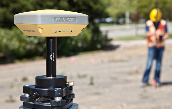
 You have surely heard of GNSS (Global Navigation Satellite System). This term refers to a satellite-based navigation system that pinpoints the exact position of a user no matter where it might be located in the world. The receivers may be all-purpose receivers, generic, or built with specific applications in mind.
How GNSS Works
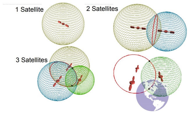
Satellite navigation systems employ a triangulation version to locate the user's receiver by means of calculations that involve information from numerous satellites. Those satellites transmit coded signals at specific intervals. Then these signals are converted by a receiver into position, time, and velocity estimates.
In this way any receiver which is placed near or on the earth's surface calculates the exact geographic location of the transmitting satellite as well as the distance between that particular satellite and the user's receiver. The receiver determines its position by coordinating up-to-date signal data from at least four satellites at a time. Each GNSS system engages a group of orbiting satellites that are connected to ground stations' network.
Accuracy
GNSS precision varies and it mainly depends on the special technology used. For instance, the US Department of Defense had originally used a Selective Availability of GPS signals in order to keep the positioning data from possible military opponents. It resulted in a limited GPS accuracy, up to 100 meters for civilian users. Without this intentional degradation, GPS receivers provide accuracy till up to 15 meters.
Major GNSS Systems in the World
 Currently, there are two major GNSS systems in operation: GPS (the United States Global Positioning System owned by the US government) and GLONASS (Global Orbiting FDMA Navigation Satellite System owned by the Russian Federation).
With more than 70 navigation satellites having been launched, GPS is the leading global GNSS system and it provides both time and geolocation info to GPS receivers all around the globe. It requires a minimum of 24 satellites at a time for a full constellation.
The Russian GLONASS presents an alternative to the GPS, meaning it's the second space-based navigational system in the world. It covers all of Russia's territory and involves the 24-satellite orbital constellation that enables full global coverage.
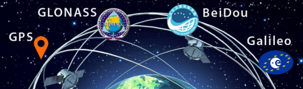
Apart from these two major Global Navigation Satellite Systems, there's also Europe's Galileo positioning satellite system followed by India's NAVIC, China's BeiDou, and Japan's Quasi-Zenith Navigation Satellite System. Those are of less importance, though.
 GNSS Applications
The initial goal of GNSS technology was to aid the military. However, with great availability of low-cost GNSS receivers and free GNSS signals, its applications have expanded in scientific, industrial, and civil areas.
As far as civil applications are concerned, GNSS is generalized so that each Global Navigation Satellite system in construction or in operation takes some civil application.
The most important types of GNSS civil applications include:
- Personal Applications - Pedestrian Navigation, Outdoor Navigation, Social Networking, Photography Geocoding, and Location Based Services
 - Rail Applications - Safety-critical applications (train control and signaling) and Non-safety-critical applications (goods tracking, fleet management, and logistic information management)
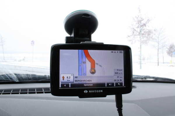
 - Road Applications - Car navigation, Tolling, Vehicle Tracking, Traffic Management, Emergency Services, and Fleet Management
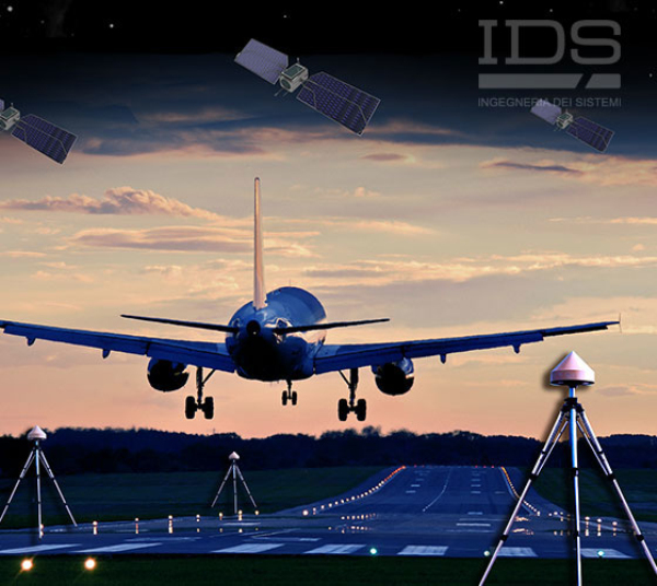
 - Aviation Applications - GNSS Augmentation, Attitude Determination, and Air Traffic Control.
 - Industry Applications - Precision Agriculture, Package & Container Tracking, and Mining.
 - Maritime Applications - En Route Navigation, AIS & VTS systems, Wrecks location, Observing the sea level, Dredging operations, Laying pipelines, Dynamic positioning, Search of sinking vessels, and Positioning of oil rigs
 Next Generation of GNSS
Majority of GNSS users possess receivers that use GPS and GLONASS. Generally that equates to 13-20 satellites in view with average terrain and clear sky. The demand for high precision GNSS continuously grows, as users work in more difficult environments.
The current GPS constellation is full that it will not include more than 31 satellites in the foreseeable future. Likewise, GLONASS includes a total of 24 satellites and it's unlikely that it will expand anytime soon.
 So what will be the solution to this issue? The solution lies in European Union's Galileo, followed by China's BeiDou. These GNSS systems will continue to develop using more high-precision technologies and more satellites. In the near future (by 2020 for BeiDou and by 2018 for Galileo), we can expect to see the following satellites layout:
- 31 GPS
- 24 GLONASS
- 30 Galileo
- 30 BeiDou
As you can see, there will be many more satellites than what we currently have, which will result in greater coverage and better quality of the signals. This means the user community won't solely rely on the GPS constellation to enhance performance.
Get ready folks! The next generation of GNSS technology with improved receivers and expanded geodatabase is about to start.

